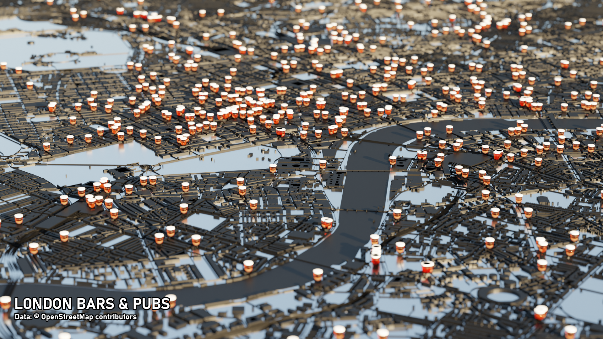
London Bars and Pubs
Created as part of #30DayMapChallenge
Behind the Scenes
Getting geographic information is relatively straight-forward using the BlenderGIS plugin and shapefiles using QGIS. I’d like to be able to automate more but for now, here’s rough overview of the workflow:
Create a bounding box for the area you’re interested in. I find it helpful to use the QuickMapServices plugin to zoom in and then add a new polygon vector layer for the bounding box:
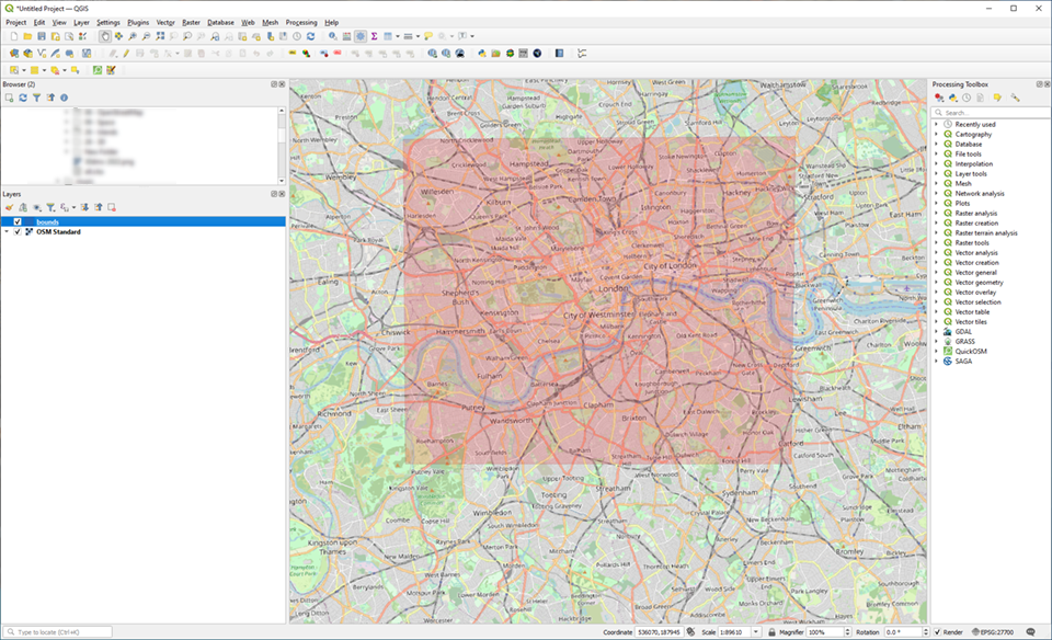
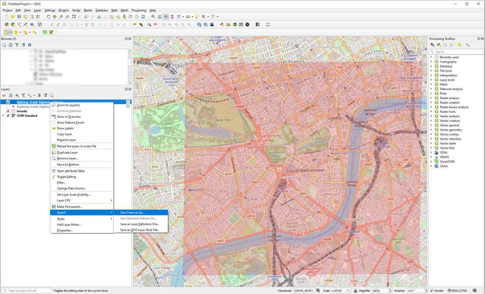
We can then use the QuickOSM plugin to download the OpenStreetMap features that we are interested in. Restrict the query to “Layer Extent” and select the layer with the bounding box. Click Run Query and wait for the plugin to work it’s magic. Once we have the OSM details, we can create a shapefile using “Export->Save Features As…”
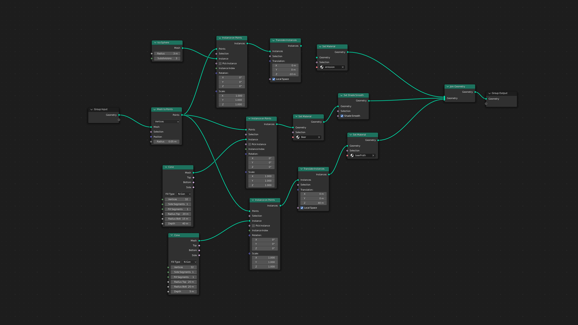
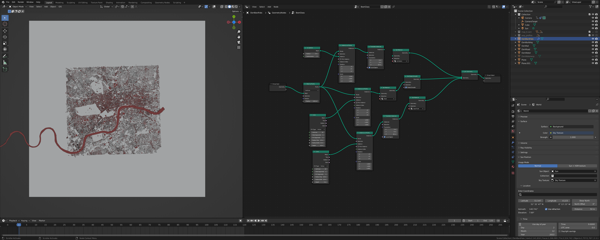
Now we have a shapefile, we can import into Blender with BlenderGIS. There are a couple of gotchas - in particular, the CRS needs to be in metres. Once in Blender we can use the geometry as a starting point. For example:
- road polygons could be converted to paths and a Bevel depth added
- building polygons could be extruded on the z-axis to give depth
- a point mesh (bars and pubs) can be used as an input to Blender’s geometry nodes. I instanced some cones using the ‘instance on points’ node to create the beer glassed and a couple of shaders to create the materials